Typical year data is commonly used for solar resource availability assessment at potential project sites or for running energy simulations to obtain P50 solar production estimates. SolarAnywhere® typical year files can be downloaded with access to a Typical Year, Typical Year+ or Sites license.
SolarAnywhere typical year data can be downloaded or requested as either a typical GHI year (TGY) or typical DNI year (TDY) file.
Download Typical-Year Data Sample (CSV File)How to Access
Typical year datasets are currently offered through our Typical Year and Sites licenses, with access through the SolarAnywhere online data portal or SolarAnywhere API.
Access via the SolarAnywhere website
Typical year files are available for instant download through the SolarAnywhere data website. These files can be accessed in the Typical Year, Typical Year+, Sites or Public tabs and choosing the ‘Typical Year’ data type.
To download a typical-year file:
-
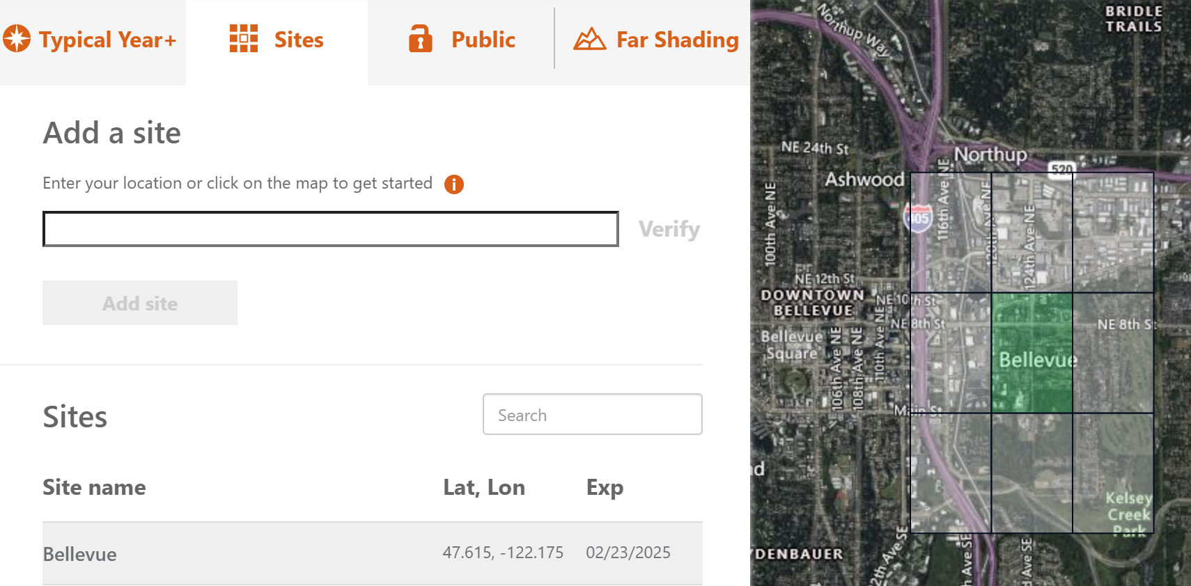
- Select a tile location for download by searching by the site location or by selecting a tile on the map:
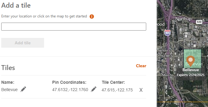
Figure 1. Selecting a Typical Year Tile on the SolarAnywhere Data website
- Click “Edit Settings”
- Check the box next to “TGY” and/or “TDY” under “Typical year options”:
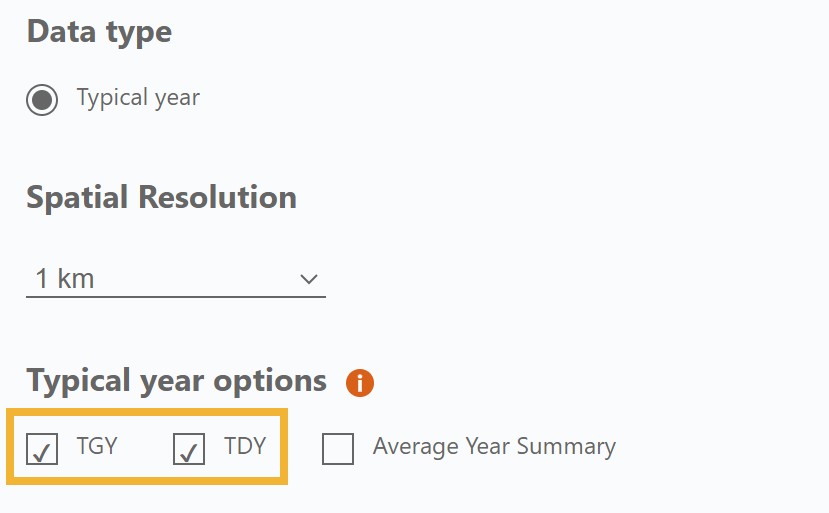
Figure 2. Selecting the TGY/TDY file Options on the SolarAnywhere Data Website
- Select the preferred datasets, delivery format and delivery method, and click “Confirm.”
- Choose “Get Data” and “Confirm” and the file will begin the download process.
- Navigate to the Files tab to download and view the file:
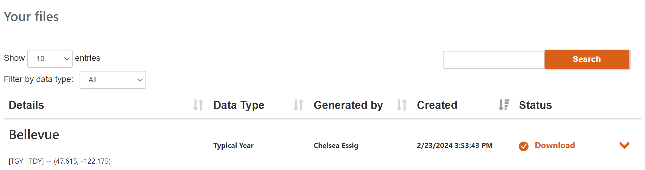
Figure 3. Files Tab on the SolarAnywhere Data Website
- Select a tile location for download by searching by the site location or by selecting a tile on the map:
Users can demo typical year files with SolarAnywhere Public.
Access via the SolarAnywhere API
Typical year data can also be requested through the SolarAnywhere API. Visit the following pages of our API Documentation to access example typical-year irradiance & weather requests:
Typical Year File Generation
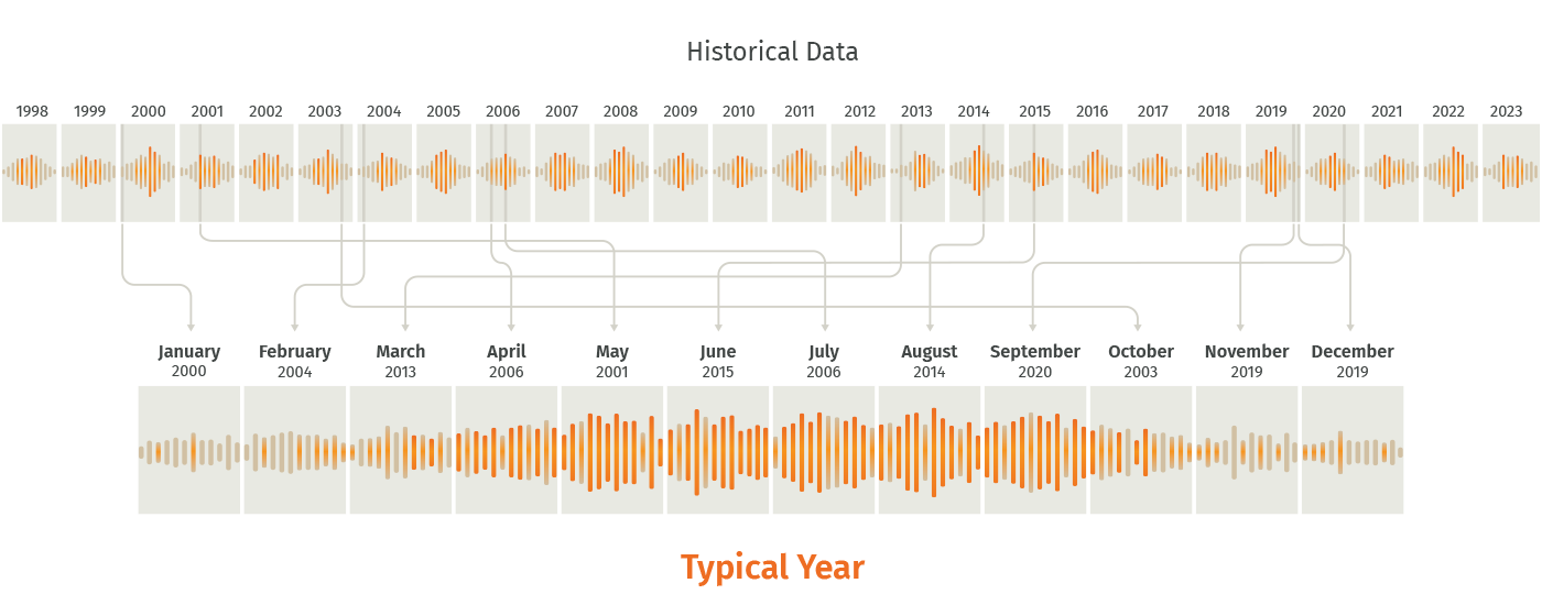
Typical year files contain a years’ worth of hourly observations (8760 hourly observations) selected with 100% weighting on either GHI or DNI. The files are generated for a specified location using the following two-step process:
-
- The long-term average monthly total irradiance is calculated for each month. The years considered in calculating the long-term averages is dependent upon the geographic data region:
- The actual months in the historic record with the monthly total irradiance values closest to the long-term averages calculated in step 1 are included in the TGY or TDY files.
- The long-term average monthly total irradiance is calculated for each month. The years considered in calculating the long-term averages is dependent upon the geographic data region:
The final TGY or TDY file will include 12 months of actual data from various years in the historical time series. For example, if January of 2010 has the monthly total irradiance closest to the long-term average monthly total irradiance for all Januarys as calculated in step 1, it will be included in the file. This is illustrated below.
Spatial Resolution
With a Typical Year+ license, typical year irradiance and weather data in TGY, TDY and Average Year Summary formats can be accessed at the best available native spatial resolutions, including standard (10 km nominal) and enhanced (1 km nominal). Base Typical Year licenses include the same irradiance and weather data as Typical Year+ licenses, but only in standard (10 km nominal) resolution.
Higher native resolution, such as 1 km nominal, increases irradiance data precision for solar energy projects, and ensures the lowest uncertainty when assessing solar resource availability.
For additional information on data resolution supported by SolarAnywhere, please visit the data resolution page or contact SolarAnywhere Support at support@solaranywhere.com.
TGY vs. TDY
Typical GHI Year (TGY) files are commonly used for running energy simulations to obtain P50 solar production estimates. When modeling tracking systems, however, it can be useful to compare simulation outputs based on Typical DNI Year (TDY) data to outputs based on TGY data.
It is more important to have an accurate representation of typical DNI conditions in modeling tracking systems than in modeling fixed tilt systems, and in some cases, the TDY data has been found to produce more representative results than the TGY data. TDY files are also useful in modeling concentrated PV plants.
TMY Data
SolarAnywhere TGY and TDY data are SolarAnywhere’s version of TMY data. TMY stands for typical meteorological year. This term was originally used by NREL to describe the dataset they first released in 1977 that used ground measurement data collected from 1952-1975 to generate weather data files containing a year of hourly meteorological data. These files were originally generated for use in facilitating solar heating and cooling simulations for buildings.1
Since the first NREL TMY dataset was released in 1977, NREL has released two additional versions: TMY2 in 1994, and TMY3 in 2007. The data and methodologies used to generate TMY files has been refined throughout the years to provide datasets more specific to solar PV modeling use cases. TMY file construction methodology can vary by data provider, but in general, the months of data selected to represent typical conditions are now more heavily weighted on the solar irradiance fields than the additional weather fields (ambient temperature, wind speed, etc.).
The white paper, “How Misuse of Solar Resource Datasets Is Reducing Solar Industry Profits” provides a helpful comparison of SolarAnywhere typical year and NREL TMY3 datasets.
References
- T. Freeman. 1979. “Evaluation of the “Typical Meteorological Years” for Solar Heating and Cooling System Studies Final Report.” Altas Corporation.